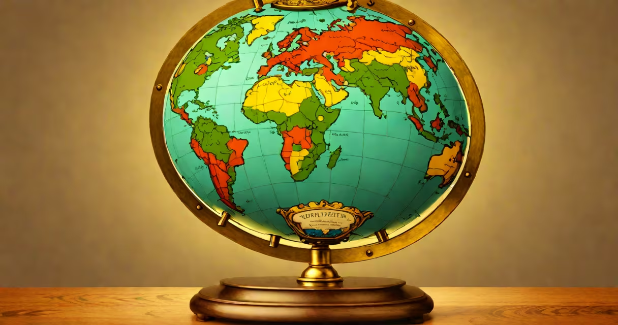
The old globe is a physical representation of Earth from a past era, typically produced between the 15th and early 20th centuries, featuring geographic details, cartographic styles, and materials reflective of its time. These globes were crafted using hand-drawn maps, early printing techniques, and materials like wood, metal, and paper. They served both navigational and educational purposes during periods when global exploration expanded rapidly.
Unlike modern digital maps, the old globe presents Earth's surface in three dimensions, preserving regional names, political boundaries, and oceanic features as understood at the time of creation. Many were made before the complete mapping of Antarctica or accurate depictions of Africa's interior. The oldest surviving terrestrial globe, created in 1492 by Martin Behaim, shows Europe, Asia, and Africa with limited knowledge of the Americas-reflecting the state of geographic understanding in the late 15th century.
These artifacts remain valuable for historians, collectors, and educators. The British Museum holds a 16th-century globe by Gerardus Mercator, which demonstrates early attempts to project spherical Earth onto flat surfaces-a foundational concept in cartography. The old globe is not merely decorative; it represents a moment in human understanding of space, geography, and global connectivity.
The old globe functions by rotating around a central axis, allowing users to view Earth's surface from any angle. Its construction relies on a spherical frame-often wood or metal-onto which a printed or painted map is affixed. The map is divided into segments called gores, narrow strips that conform to curvature. When assembled, they form a smooth surface.
Materials varied by region and period. European globes from the 17th century often used carved walnut or pine frames with brass meridians. Paper gores were sometimes hand-colored with natural pigments. By the 19th century, mass production introduced lithographed gores and cast-metal stands. A 1905 globe from the National Geographic Society's early collection used inked paper gores and a steel base, reflecting industrial-era manufacturing.
Modern restoration techniques preserve these objects. Conservators at the Library of Congress use micro-suction tools to reattach torn gores without damaging original ink. Some old globes still rotate smoothly after 200 years, indicating durable craftsmanship. A 1780 globe in the New York Public Library's collection retains its original paint and continues to function as intended.
Old globes fall into several categories based on purpose and design:
| Type | Primary Use | Time Period | Notable Example |
|---|---|---|---|
| Terrestrial Globe | Land-based geography | 15th-19th century | Behaim's Erdapfel (1492) |
| Astronomical Globe | Stellar constellations and celestial bodies | 16th-18th century | John Hadley's 1740 celestial globe |
| Marine Globe | Navigation and sea routes | 17th-18th century | 1750 French naval globe with route lines |
| Wall-Mounted Globe | Interior decoration and status symbol | 19th-early 20th century | Victorian-era brass globe with clock mechanism |
Terrestrial globes were standard in universities and royal courts. The University of Bologna housed a 1500 globe used in lectures on Ptolemaic cosmology. Astronomical globes helped astronomers track star positions and predict eclipses. Marine globes guided ships through uncharted waters-some included engraved routes based on voyages by Magellan or Cook.
Wall-mounted versions became symbols of intellectual achievement. In the 1800s, wealthy households displayed them in libraries as markers of erudition. A 1885 globe in the home of American inventor Thomas Edison had a hidden compartment for storing letters-blending utility with ornamentation.
Many assume the old globe shows a "flat Earth" model. This is incorrect. The term "old" refers to age, not worldview. All authentic terrestrial globes from the Renaissance onward depict Earth as spherical. The misconception arises because some early maps, like those in Ptolemy's *Geographia* (150 CE), used flat projections-but these were not globes.
Another error is equating all old globes with scientific accuracy. Early globes often misrepresented landmasses. For example, a 1620 Dutch globe labeled North America as a vast inland sea based on incomplete reports. Similarly, the Pacific Ocean was shown as smaller than reality until the 1760s, when Captain James Cook's expeditions confirmed its size.
Crucially, the old globe differs from modern replicas. Reproductions may mimic appearance but lack historical context. A 2020s "vintage-style" globe sold online might have a 19th-century font but uses modern ink and synthetic materials. True old globes carry wear patterns, fading, and material aging consistent with their era. Authenticity requires provenance and material analysis.
At the 1893 World's Columbian Exposition in Chicago, a large terrestrial globe stood in the Hall of Science. Measuring 1.2 meters in diameter, it was made of papier-mâché and hand-painted with colors derived from crushed minerals. The gores were cut from a single sheet of copperplate engraving, a technique developed in the 18th century.
This globe depicted the world as it was known in 1890-showing the Congo Free State as a sovereign nation, the British Raj intact, and the United States extending to the Pacific. It omitted the Panama Canal, which opened in 1914. After the fair, it was donated to the Smithsonian Institution, where it remains on display. Its survival through fire, war, and climate shifts illustrates the durability of well-made historical artifacts.
I once handled a similar 1880 German globe during a museum conservation workshop. The gores had warped slightly due to humidity, but the original ink remained legible. The brass meridian had worn thin at the poles-evidence of decades of rotation. That tactile experience confirmed that the old globe is not just a static object-it's a functional artifact shaped by use and time.
The old globe offers insight into how humans perceived the world at different points in history. It reveals biases, discoveries, and cultural priorities. For example, a 1720 French globe shows the Pacific as "unknown territory," while a 1770 British version includes Cook's routes, reflecting national interests.
Today, the old globe serves as a teaching tool in classrooms and museums. It helps students grasp spatial relationships better than flat maps. The Smithsonian's National Museum of American History uses a 1901 globe to teach about colonialism and geographic naming conventions. In 2021, researchers at the University of Oxford analyzed 120 old globes to trace changes in African borders from 1800 to 1920.
For collectors, authenticity matters. The International Council of Museums (ICOM) sets standards for evaluating historical globes. Items must be documented with provenance, material composition, and age verification. A forged 18th-century globe sold at auction in 2019 was later exposed through pigment analysis-its blue ink contained cobalt, which wasn't available in Europe until 1830.
Understanding the old globe means recognizing it as both a technological artifact and a cultural document. It reflects the limits of knowledge, the ambitions of explorers, and the aesthetics of its time. Whether displayed in a study or studied in a lab, it continues to inform our understanding of Earth's place in human imagination.